Bryan, Texas
| City of Bryan | |
|---|---|
| — City — | |
| Nickname(s): The Good Life, Texas Style. | |
 |
|
| Coordinates: | |
| Country | United States |
| State | Texas |
| County | Brazos |
| Government | |
| - Mayor | Jason Bienski |
| Area | |
| - Total | 43.3 sq mi (112.3 km2) |
| - Land | 43.29 sq mi (112.1 km2) |
| - Water | 0.01 sq mi (0.2 km2) |
| Elevation | 374 ft (114 m) |
| Population (2007) | |
| - Total | 67,266 |
| - Density | 1,515.2/sq mi (584.9/km2) |
| Time zone | CST (UTC-6) |
| - Summer (DST) | CDT (UTC-5) |
| Area code(s) | 979 |
| FIPS code | 48-10912[1] |
| GNIS feature ID | 1353099[2] |
| Website | [1] |
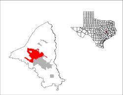
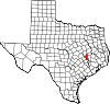
Bryan is a city in Brazos County, Texas, United States. As of the 2000 census, the city had a total population of 65,660. It is the county seat of Brazos County[3] and is located in the heart of the Brazos Valley (Southeast Central Texas). It shares its border with the city of College Station, which lies to its south. Together they are referred to as the Bryan-College Station metropolitan area, the sixteenth largest Metropolitan area in Texas containing around 190,000 people.
The city is centrally located, approximately equidistant from three of the 10 largest cities in the United States. It is 92 miles (148 km) north-northwest of Houston, 166 miles (267 km) northeast of San Antonio and 169 miles (272 km) south of Dallas. It is 104 miles (167 km) east of Austin, the state capital of Texas. 75% of the Texas and Louisiana populations (13.1 million people) live within 3.5 driving hours of Bryan.
Contents |
History
The area around Bryan, Texas was part of a land grant to Moses Austin by Spain. Moses Austin's son, Stephen F. Austin helped bring settlers to the area. Among the settlers was William Joel Bryan, the nephew of Stephen F. Austin. The town of Bryan was founded in 1821. It grew quickly when the Houston and Texas Central Railroad arrived in 1860. In 1866, the county seat of Brazos County, Texas was changed from Boonville, Texas to Bryan. A short time later, in 1871, the City of Bryan became incorporated.
- 1820s: Area settled by members of Stephen F. Austin's colony.
- 1859: The Houston and Texas Central Railroad is built in the area.
- 1866: A post office was granted and Bryan replaced Boonville, Texas as the Brazos County seat.
- 1867: The railroad that had stopped at Millican, Texas because of delays during the Civil War reached Bryan.
- 1871: The first Bryan courthouse was built.
- 1872: Bryan is incorporated.
- 1876: Texas A&M College opens nearby in what became College Station, Texas.
- 1877: The Bryan Independent School District was established.
- 1884: Population reaches 3,000.
- 1889: Bryan obtained electric lighting and a waterworks.
- 1892: Bryan's fifth Brazos County Courthouse was built.
- 1900: The International-Great Northern Railroad arrived in Bryan.
- 1900: Population reaches 3,589.
- 1902: Bryan's Carnegie Library was opened with a $10,000 grant from Andrew Carnegie.
- 1910: Bryan builds an interurban railroad to College Station, Texas, which is abandoned in 1923.
- 1910: Population reaches 4,132.
- 1920: Population reaches 6,307.
- 1930s: North Oakwood merges with Bryan so Bryan and College Station, become "twin" cities.
- 1930: Population reaches 7,814.
- 1936: State Highway 6 is built through Bryan.
- 1940: Population reaches 11,842.
- 1950: Population reaches 18,072.
- 1960: Population reaches 27,542.
- 1970: Population reaches 33,141.
- 1980: Population reaches 44,337.
- 1990: Population reaches 55,002.
- 2000: Population reaches 65,660.
- 2006: The Texas A&M University System announces the new Texas A&M Health Science Center campus will be built in Bryan near the new Traditions Golf Course development.
- 2009: A fire at the El Dorado Chemical Co. caused the evacuation of 70,000 residents due to the ammonium nitrate burning possibly causing minor respiratory problems.[4] However the city only requested that "anyone who can smell smoke or see smoke to evacuate their homes and businesses" and did not enforce an evacuation except for a 500 homes in the nearby vicinity of the fire.[5][6] Less than 1,000 residents chose to evacuate, taking shelter at Texas A&M University, which closed its campus for the day to ease traffic problems. City fire officials chose to let the fire burn down before tackling it as the chemicals are water reactive.[5][7][8] The evacuation, which started at 2:30 pm CST ended at 7 pm except for a small, defined area immediately around the fire, where approximately 100 Bryan residents live.[7] In the end, only 500 residents were under a mandatory evacuation, and 35 peoples were treated for respiratory problems from the smoke, while officials from El Dorado said there was never any danger from the smoke or fire. The warehouse, valued at just under $1 million, was destroyed.[6]
Geography
Bryan is located at (30.665547, -96.366745).[9]
According to the United States Census Bureau, the city has a total area of 43.4 square miles (112.5 km2), of which, 43.3 square miles (112.3 km2) of it is land and 0.1 square miles (0.2 km2) of it (0.21%) is water.
Climate
The local climate is subtropical and temperate and winters are mild with periods of low temperatures usually lasting less than two months. Snow and ice are extremely rare. Summers are warm and hot with occasional showers being the only real variation in weather.
| Climate data for Bryan, Texas | |||||||||||||
|---|---|---|---|---|---|---|---|---|---|---|---|---|---|
| Month | Jan | Feb | Mar | Apr | May | Jun | Jul | Aug | Sep | Oct | Nov | Dec | Year |
| Record high °F (°C) | 86 (30) |
99 (37.2) |
94 (34.4) |
94 (34.4) |
100 (37.8) |
104 (40) |
109 (42.8) |
108 (42.2) |
106 (41.1) |
98 (36.7) |
89 (31.7) |
86 (30) |
109 (42.8) |
| Average high °F (°C) | 61 (16.1) |
66 (18.9) |
73 (22.8) |
79 (26.1) |
85 (29.4) |
92 (33.3) |
96 (35.6) |
96 (35.6) |
91 (32.8) |
82 (27.8) |
71 (21.7) |
63 (17.2) |
80 (26.7) |
| Average low °F (°C) | 40 (4.4) |
44 (6.7) |
50 (10) |
57 (13.9) |
65 (18.3) |
72 (22.2) |
74 (23.3) |
73 (22.8) |
69 (20.6) |
59 (15) |
49 (9.4) |
42 (5.6) |
63 (17.2) |
| Record low °F (°C) | 7 (-13.9) |
14 (-10) |
17 (-8.3) |
28 (-2.2) |
42 (5.6) |
53 (11.7) |
58 (14.4) |
60 (15.6) |
44 (6.7) |
29 (-1.7) |
19 (-7.2) |
2 (-16.7) |
2 (-16.7) |
| Precipitation inches (mm) | 3.32 (84.3) |
2.38 (60.5) |
2.84 (72.1) |
3.20 (81.3) |
5.05 (128.3) |
3.79 (96.3) |
1.92 (48.8) |
2.63 (66.8) |
3.91 (99.3) |
4.22 (107.2) |
3.18 (80.8) |
3.23 (82) |
39.67 (1,007.6) |
| Source: weather.com[10] | |||||||||||||
Demographics
As of the census[1] of 2000, there were 65,660 people, 23,759 households, and 14,873 families residing in the city. The population density was 1,515.2 people per square mile (584.9/km2). There were 25,703 housing units at an average density of 593.1/sq mi (229.0/km2). The racial makeup of the city was 64.65% White, 17.72% African American, 0.40% Native American, 1.65% Asian, 0.08% Pacific Islander, 13.32% from other races, and 2.17% from two or more races. Hispanic or Latino of any ethnicity/nationality were 27.83% of the population.
There were 23,759 households out of which 32.3% had children under the age of 18 living with them, 44.2% were married couples living together, 14.0% had a female householder with no husband present, and 37.4% were non-families. 26.1% of all households were made up of individuals and 7.7% had someone living alone who was 65 years of age or older. The average household size was 2.65 and the average family size was 3.27.
In the city the population was spread out with 27.0% under the age of 18, 18.1% from 18 to 24, 29.8% from 25 to 44, 15.8% from 45 to 64, and 9.3% who were 65 years of age or older. The median age was 28 years. For every 100 females there were 99.2 males. For every 100 females age 18 and over, there were 95.7 males.
The median income for a household in the city was $31,672, and the median income for a family was $41,433. Males had a median income of $29,780 versus $22,428 for females. The per capita income for the city was $15,770. About 15.5% of families and 22.3% of the population were below the poverty line, including 27.0% of those under age 18 and 11.7% of those age 65 or over.
Government and infrastructure
The Texas Department of Criminal Justice (TDCJ) operates the Hamilton Unit, a pre-release facility in Bryan.[11] Hamilton opened as an adult prison facility. It was renovated for juveniles and, in mid-1997,[12] re-opened as the Texas Youth Commission (TYC) J.W. Hamilton Jr. State School. On June 15, 2003, the facility was transferred back to the TDCJ.[13] The TDCJ also operates the Bryan District Parole Office in nearby College Station.[14]
The United States Postal Service operates the Bryan and Downtown Bryan post offices.[15][16]
Economy
Major employers include:
- Texas A&M University (~19,000 Employees)
- Bryan Independent School District (~2,000 Employees)
- Sanderson Farms (~1,400 Employees)
- St. Joseph Regional Health Center (~1,600 Employees)
- City of Bryan (~1,000 Employees)
- Alenco (~500 Employees)
Sports
- Football: Kyle Field (Largest Crowd: 88,253)
- Football: Meryl Green Stadium (Capacity 10,000)
- Racing: Texas World Speedway (Capacity: 23,000)
- Basketball: Reed Arena (Largest Crowd: 12,811)
- Baseball: Olsen Field (Largest Crowd: 11,052)
- Baseball: Travis Field
- Volleyball: G. Rollie White Coliseum (Largest Crowd: 3,778)
- Track and Field: Anderson Track and Field Complex (Capacity: 3,500)
- Soccer: Aggie Soccer Complex (Capacity: 2,275)
- Soccer: Bryan Regional Athletic Complex (BRAC)
- Softball: Aggie Softball Complex (Capacity: 1,750)
- Tennis: George P. Mitchell Tennis Center (Capacity: 1,500)
- Hockey: Arctic Wolf Ice Center (Capacity: 500)
- Golf: Traditions Golf Course at University Ranch
- Golf: Miramont Country Club
- Golf: Pebble Creek Country Club
- Golf: Bryan Municipal Golf Course
- Fishing: Lake Bryan
- Skydiving: Coulter Field/Skydive Aggieland
Education
Universities and colleges
- Blinn College - Bryan Campus
- Texas A&M Health Science Center
Area school districts
- Bryan Independent School District
Area independent schools
- Allen Academy: PK-12 College Preparatory
- St. Joseph Catholic School: PK-12 College Preparatory
- St. Michaels Academy: PK-12 College Preparatory
- Brazos Christian School: PK-12 College Preparatory
Media
Radio
- KAMU-FM NPR 90.9 (National Public Radio)
- KJXJ-FM 103.9 JACK FM (Adult Hits)
- KBXT 101.9 THE BEAT
- KKYS Mix 104.7 (Hot A/C)
- KNFX-FM 99.5 The Fox (Classic Rock)
- KNDE 95.1 Candy 95 (Top 40)
- KVJM 103.1 La Preciosa (Regional Mexican)(Formerly V103.1 Hip Hop/Power 94)
- KTEX 106.1 Texas Country (Country)
- KAGG 96.1 Aggie 96 (Country)
- KORA 98.3 (Country)
- KZNE 1150 The Zone (ESPN Sports Radio)
- WTAW 1620 (Talk Radio)
- KTAM 1240 Radio Alegria (Regional Mexican)
- KEOS 89.1 (community radio)
101.9 The Beat
Television
- KBTX-TV 3 (CBS) (Daily, Live Newscasts from studio on 29th Street in Bryan, Texas)
- KAMU-TV 15 (PBS)
- KYLE-TV 28 (FOX) (Taped Newscast weekday nights from Tyler, TX rarely covering Bryan)
- KRHD-TV 40 (ABC) (Daily, Taped Newscasts, from Waco, Texas)
- KMAY-TV 23 (NBC) (Daily, Live Newscasts from Temple, Texas rarely covering Bryan)
Publications
- The Bryan/College Station Eagle (Main newspaper)
- The Battalion (Texas A&M)
- The Press
Infrastructure
Transportation
The District began offering public transportation in the Bryan-College Station in 1974. It offers fixed bus routes throughout Bryan-College Station. Operating on weekdays on an hourly basis, the seven routes converge at a central location for transferring between routes.[17][18] It also offers paratransit services for disabled riders and an on-demand shared ride service.[19] Texas A&M University, headquartered in sister city College Station, operates student-driven free buses on weekdays for use by the general public that includes coverage around several apartment complexes in Bryan near campus and along a route that culminates at the Blinn College campus.[20][21][22]
Airports
Bryan is served commercially by Easterwood Airport, a regional airport operated by Texas A&M University in College Station, TX.[23] Continental Connection and American Eagle offer flights to and from their larger hub airports at George Bush Intercontinental Airport (Continental) and Dallas Fort Worth International Airport (American).[24][25][26]
The city of Bryan owns and operates Coulter Field, operating as American Flight Services, a fixed base operator offering services, hanger space, and runways for private flights.[27][28]
Major roads
- U.S. Highway 190
- State Highway 6: Earl Rudder Freeway (East Loop)
- State Highway 6 Business: Texas Avenue
- State Highway 21: San Jacinto
- State Highway 47
- Farm to Market Road 60: University Drive
- Farm to Market Road 158: William J. Bryan Parkway / Boonville Road
- Farm to Market Road 974: Tabor Road
- Farm to Market Road 1179: Briarcrest Drive
- Farm to Market Road 2154: Wellborn Road
- Farm to Market Road 2818: Harvey Mitchell Parkway (West Loop)
Health care
- St. Joseph Regional Health Center (316 Bed/Level III Trauma Center)
- College Station Medical Center (119 Bed/Level III Trauma Center)
- St. Joseph Health Campus College Station (Announced)
- Scott & White Clinic (Outpatient)
- The Physicians Centre (16 Bed/Specialty Outpatient)
Notable people
- Gerald Carter - National Football League wide receiver (Jets/Bucs)
- Linda Ellerbee - NBC broadcast journalist
- Claude Hall - historian[29]
- Devin Lemons - National Football League linebacker (Redskins)
- Shawn Slocum - Special teams coordinator of the Green Bay Packers
- Doug Supernaw - country music artist
- Ty Warren - National Football League defensive-end (Patriots)
- Melvin Bullitt - National Football League free safety (Colts)
- Jack Kingston - U.S. Representative from First District of Georgia
- Syndric Steptoe - National Football League wide receiver (Browns)
- Raini Rodriguez - An actress who appeared in Paul Blart: Mall Cop and an episode of the Suite Life of Zack and Cody.
Sister cities
- Greifswald, Germany[30]
- Kazan, Russia[30]
- Zuazua, Mexico[30]
See also
- College Station, Texas - neighboring sister city
- James Bryan - The name "Bryan" traces back to him in particular.
References
- ↑ 1.0 1.1 "American FactFinder". United States Census Bureau. http://factfinder.census.gov. Retrieved 2008-01-31.
- ↑ "US Board on Geographic Names". United States Geological Survey. 2007-10-25. http://geonames.usgs.gov. Retrieved 2008-01-31.
- ↑ "Find a County". National Association of Counties. http://www.naco.org/Template.cfm?Section=Find_a_County&Template=/cffiles/counties/usamap.cfm. Retrieved 2008-01-31.
- ↑ Linthicum, Kate (2009-07-31). "Thousands evacuated amid Texas factory fire". Los Angeles Times. http://www.latimes.com/news/nationworld/nation/la-na-chemical-fire31-2009jul31,0,6298501.story. Retrieved 2009-07-30.
- ↑ 5.0 5.1 "City of Bryan News". City of Bryan. July 30, 2009. http://www.bryantx.gov/press/news.html?id=599. Retrieved July 30, 2009.
- ↑ 6.0 6.1 "Blaze prompts mass evacuation in Bryan". The Bryan-College Station Eagle. July 31, 2009. http://www.theeagle.com/local/Blaze-prompts-mass-evacuation-in-Bryan. Retrieved July 31, 2009.
- ↑ 7.0 7.1 "Evacuations Ordered Following Hazmat Fire in Bryan". KBTX. July 30, 2009. http://www.kbtx.com/home/headlines/52085082.html. Retrieved July 30, 2009.
- ↑ KBTX 6pm broadcast
- ↑ "US Gazetteer files: 2000 and 1990". United States Census Bureau. 2005-05-03. http://www.census.gov/geo/www/gazetteer/gazette.html. Retrieved 2008-01-31.
- ↑ "Monthly Averages for Bryan, TX". Weather.com. The Weather Channel. http://www.weather.com/outlook/homeandgarden/home/wxclimatology/monthly/77802. Retrieved July 30, 2009.
- ↑ "Hamilton Unit." Texas Department of Criminal Justice. Retrieved on May 6, 2010.
- ↑ "11 TEENS ESCAPE JUVENILE CENTER; 6 STILL MISSING." Chicago Tribune. December 13, 1998. Retrieved on August 22, 2010. "Hamilton State School a former adult prison was renovated for juvenile offenders and reopened in mid1997."
- ↑ "Secure TYC Facilities by Opening Date." Texas Youth Commission. Retrieved on May 6, 2010.
- ↑ "Parole Division Region I." Texas Department of Criminal Justice. Retrieved on May 15, 2010.
- ↑ "Post Office™ Location - BRYAN." United States Postal Service. Retrieved on May 15, 2010.
- ↑ "Post Office™ Location - DOWNTOWN BRYAN." United States Postal Service. Retrieved on May 15, 2010.
- ↑ "Bryan College Station". The District. http://www.btd.org/BryanCollegeStation.htm. Retrieved July 30, 2009.
- ↑ "Bryan Map for Web" (PDF). The District. http://www.btd.org/images/Bryan%20map%20for%20WEB.pdf. Retrieved July 30, 2009.
- ↑ "Paratransit". The District. http://www.btd.org/Paratransit.htm. Retrieved July 30, 2009.
- ↑ "Off-Campus Transit Routes". Texas A&M University. http://transport.tamu.edu/transit/offcampus.aspx. Retrieved July 30, 2009.
- ↑ "Route 12" (PDF). Texas A&M University. http://transport.tamu.edu/transit/routemaps/12.pdf. Retrieved July 30, 2009.
- ↑ "Route 15" (PDF). Texas A&M University. http://transport.tamu.edu/transit/routemaps/15.pdf. Retrieved July 30, 2009.
- ↑ "What We Do". Easterwood Airport. http://www.easterwoodairport.com/wwd.html. Retrieved July 30, 2009.
- ↑ "FAQ". Easterwood Airport. http://www.easterwoodairport.com/faq.html#1. Retrieved July 30, 2009.
- ↑ "Arrivals". Easterwood Airport. http://www.easterwoodairport.com/arrival.html. Retrieved July 30, 2009.
- ↑ "Departures". Easterwood Airport. http://www.easterwoodairport.com/depart.html. Retrieved July 30, 2009.
- ↑ "About". Coulter Field. http://www.coulterfield.com/about.html. Retrieved July 30, 2009.
- ↑ "Services". Coulter Field. http://www.coulterfield.com/services.html. Retrieved July 30, 2009.
- ↑ Obituary of Claude Hampton Hall (1922-2001), Bryan-College Station, Texas, Eagle, April 4, 2001
- ↑ 30.0 30.1 30.2 "Brochure". Bryan-College Station Sister Cities Association. December 17, 2008. http://bcssistercities.org/?p=83. Retrieved July 30, 2009.
External links
|
||||||||||||||
|
|||||||||||||||||
|
||||||||||||||||||||||||||||||||||||||||||||||||||||||||||||||